Below is the ultimate list of F-roads in Iceland. Each road comes with quick specs, a map, and visual references so you know exactly what you're getting into. Scroll down, pick your poison, and plan accordingly.
F26 - Sprengisandsleið (aka Sprengisandur)
One of the best F-roads in Iceland if you're looking for total isolation and brutal landscapes. It cuts straight through the Highland interior and demands respect.
Location
- Connects Hrauneyjar (south) to Bárðardalur (north)
- Runs between Hofsjökull and Vatnajökull glaciers
Length
- 250 km / 155 mi
Recommended Car
- Ideal: Large 4x4 (Toyota Hilux)
- Minimum: Mid-size 4x4 (Jeep Renegade) only in excellent conditions
Difficulty
- 5/5
River Crossings
- One major crossing: Hagakvísl near Nýidalur
- Can swell fast. Scout it. Or turn back.
Warnings
- Not for solo drivers unless you're fully prepared
- No coverage. No rescue unless you send a flare
- Always check Umferdin.is and Safetravel.is before departure
F35 - Kjalvegur (also called Kjölur or Route 35)
One of the softest entries on the map of F roads in Iceland. Long, scenic, beginner-friendly. Still, don't get cocky.
Location
- Connects Gullfoss (south) to Blönduós (north)
- Between Langjökull and Hofsjökull glaciers
Length
- 180 km / 112 mi
Recommended Car
- Best: Any 4x4 (Duster, Renegade, etc.)
- Minimum: 2WD in dry summer only, but we do not advise it
Difficulty
- 2/5
River Crossings
- None
Warnings
- Wide gravel, loose rocks, and potholes
- Busy in season. Expect dust and convoys
Key Stops Nearby
- Kerlingarfjöll
- Hveravellir
F66 - Kollafjarðarheiði
A rugged F-road that slices across the central Westfjords. Shorter than it feels, especially in bad weather.
Location
- Connects north and south Westfjords
- Mountain pass between Ísafjarðardjúp and Patreksfjörður region
Length
- 40-50 km / 25-31 mi
Recommended Car
- Ideal: Any 4x4 SUV (Duster, Renegade)
- Avoid in rain without something bigger like the Hilux
Difficulty
- 3/5.
River Crossings
- A few shallow streams. Nothing serious.
Warnings
- Slippery when wet
- Steep, narrow, and wind-prone
- Not beginner-friendly in bad weather
F88 - Öskjuleið
What are F roads in Iceland without a little tension? F88 is raw, remote, and scenic as hell. It’s also the fastest road to Askja. It’s got endless black sand flats, dusty ridges, and that one river that decides your fate.
Location
- Northern Highlands
- Connects Ring Road (near Hrossaborg) to F910 and Askja
Length
- 80 km / 50 mi
Recommended Car
- Minimum: Medium 4x4 (Duster)
- Best: Large 4x4 like Toyota Hilux
Difficulty
- 4/5
River Crossings
- One big one: Lindaá
- Can spike fast after rain
Warnings
- Faster than F905 + F910, but sketchier
- Avoid if river crossings freak you out
F206 - Lakavegur
If you're chasing isolation, lava fields, and roads that don't show up properly on Google, this one’s for you. F206 cuts through raw volcanic terrain toward the Laki craters with mossy slopes and black earth in every direction.
Location
- Southern Highlands
- Leads west off F208 toward the Laki craters and Tjarnargígur area
Length
- 25-30 km / 15-19 mi
Recommended Car
- Minimum: Medium 4x4 (Dacia Duster)
- Best: Large 4x4 if it’s been raining (Toyota Hilux)
Difficulty
- 3/5
River Crossings
- Several. At least one medium-sized. Unbridged.
Warnings
- Gets tricky fast in fog or rain
- Terrain is rough, rocky, and remote
- Don’t rely on Google for navigation. Bring offline maps
F207 - Lakagigavegur
One of the most overlooked F-roads in Iceland, but also one of the most punishing if you underestimate it. This loop around the Laki craters hits you with craters, moss plains, and absolute silence.
Location
- Southern Highlands
- Loop off F206 around the Laki craters
Length
- 20-25 km / 12-15 mi
Recommended Car
- Minimum: Medium 4x4 (Dacia Duster)
- Safer: Large 4x4 with high clearance (Hilux or Renegade)
Difficulty
- 4/5
River Crossings
- Several unbridged. At least one medium-sized
- You must cross F206 rivers first to even get here
Warnings
- Poorly marked and rough
- Known for stranded rentals
- Scout crossings, or don’t attempt at all
F208 - Fjallabaksleið Nyrðri (North)
One of the easier Highland tracks. Gravel, yes. Rough, sure. But nothing that’ll eat your car. The scenery is open and wide, with dusty ridges and distant volcanic slopes.
Location
- Highlands route from Landmannalaugar to F26
Length
- 40-50 km / 25-31 mi
Recommended Car
- Minimum: Sturdy 2WD in perfect weather
- Recommended: Any 4WD
Difficulty
- 2/5
River Crossings
- None. Dry in summer.
Warnings
- Long and bumpy
- Horses block the road sometimes. Wait it out and be patient
F208 - Fjallabaksleið Nyrðri (South)
This is where the map of F roads in Iceland starts earning its reputation. Black sand, bright moss, steep hills, and rivers that demand attention. It’s raw, scenic, and absolutely worth it if you’re prepared.
Location
- Southern Highlands
- From Ring Road near Vík to Landmannalaugar via F235
Length
- 60-70 km / 37-43 mi
Recommended Car
- Minimum: Medium 4x4 (Duster)
- Not advised: Small 4x4’s
Difficulty
- 4/5
River Crossings
- Several unbridged
- Up to 60 cm deep in August
Warnings
- Not for first-timers
- Langisjór detour is worth it
- Download maps before entry
F210 Fjallabaksleið Syðri
If you want raw, this is it. F210 runs through some of the most surreal terrain Iceland has to offer. Black deserts, moss-covered slopes, and glacier runoff tearing through riverbeds.
Location
- Crosses Fjallabak Nature Reserve
- From Thórsmörk in the west to Landmannalaugar in the east
Length
- 100 km / 62 mi
- Split by F261 midway
Recommended Car
- Minimum: Medium 4x4 (Duster)
- Best: Toyota Hilux
Difficulty
- 5/5
River Crossings
- Kaldaklofskvísl and Holmsá
- One stretch requires driving inside the river
Warnings
- Remote, steep, unstable
- Attempt only with experience and proper gear
F223 - Eldgjárvegur
A soft intro to Highland driving, this short F-road delivers big views with almost no effort. Green hills, volcanic cliffs, and a payoff hike into the Eldgjá canyon.
Location
- Branches off F208 South
- Leads directly to Eldgjá hiking area
Length
- 5-7 km / 3-4 mi
Recommended Car
- F223 itself: Any camper
- But: F208 South requires at least a medium 4x4
Difficulty
- 1/5
River Crossings
- None on F223
- All rivers are on the way in via F208
Warnings
- Easy stretch, but access is everything
- Good detour if you're already committed to the south route
x
F224 - Landmannalaugavegur
One of the best F-roads in Iceland for easy access to the good stuff. It’s short, rough, and packed with traffic, but it leads straight to the heart of Landmannalaugar. If you want your campsite near the action, this is the final stretch.
Location
- Spurs off F208 or F225
- Ends at Brennisteinsalda campsite
Length
- 4-5 km / 2.5-3 mi
Recommended Car
- Avoiding rivers: Medium 4x4 is enough
- Crossing to camp: Large 4x4 SUV is safer
Difficulty
- 2/5 (no crossing)
- 3/5 (if crossing)
River Crossings
- Two medium ones before the campsite
- Cross or walk. Your call.
Warnings
- Busy, rough, and narrow
- Don’t hesitate halfway through a crossing
F225 - Landmannaleið
Shorter, smoother, and quieter than the usual routes into Landmannalaugar. You still get the Highlands feeling, just without the chaos. Rolling hills, wide valleys, and a few rivers to keep you honest.
Location
- Connects Road 26 to Landmannalaugar
- Scenic shortcut compared to F208 North
Length
- 45 km / 28 mi
Recommended Car
- Ideal: Medium 4x4 (Duster)
- Early season: Large 4x4 only
Difficulty
- 3/5
River Crossings
- Several small to medium
- Manageable in dry conditions
- Deeper early in the season
Warnings
- Fantastic beginner route
- Avoid if glacier melt is underway
F229 - Jökulheimaleið
A rarely used route that feels more like a utility track than a destination. If you're not heading to Jökulheimar on purpose, there’s no reason to be here. The landscape is barren, dusty, and empty.
Location
- Central Highlands
- Leads west toward Jökulheimar and the edge of Tungnaárjökull glacier
Length
- 20-30 km / 12-19 mi
Recommended Car
- Minimum: Medium 4x4 (Dacia Duster)
- Better: Bigger 4x4 for comfort (Renegade or Hilux)
Difficulty
- 2/5
River Crossings
- None reported
- Terrain is sandy and rough, but dry
Warnings
- Poorly maintained
- Surrounded by worse tracks
- Skip unless glacier access is your goal
x
F232 - Öldufellsleið
A short Highland link with one photogenic river crossing and glacier views. Worth it if you’re heading between F210 and the south coast, but not a destination in itself.
Location
- Southern Highlands
- Connects F210 to the Ring Road near Álftaver, passing Öldufellsjökull glacier
Length
- 25-30 km / 15-19 mi
Recommended Car
- Minimum: Medium 4x4 SUV (Dacia Duster)
- Not suitable for 2WD
- Check conditions on connecting routes
Difficulty
- 3/5
River Crossings
- One notable crossing: Bláfjallakvísl at Bláfjallafoss
- Rocky and scenic, but manageable in summer
Warnings
- Low traffic, little support
- Decent road surface, but steep riverbanks
- Worth it only if part of a longer Highland route
F233 - Álftavatnskrókur
A brutal shortcut through the southern Highlands. Treacherous rivers, sharp rocks, and shifting paths make this one of the most demanding drives in the country. Do not underestimate it.
Location
- Connects F210 (near Mælifell) to northern F208 South
- Used by those attempting a faster route to Landmannalaugar
Length
- 20-25 km / 12-15 mi
Recommended Car
- Minimum: Toyota Hilux
- Not suitable for medium SUVs except in perfect summer conditions
Difficulty
- 5/5
River Crossings
- Multiple crossings
- Main hazard: Syðri-Ófæra river. It’s deep, cold, unpredictable, with a rocky bottom and strong current
Warnings
- Wrong line across the river can total your vehicle
- Opens late due to flooding and snowmelt
- Only for experts with recovery gear and a second vehicle
F235 - Langisjór
A scenic detour into a surreal volcanic basin west of F208 South. Leads to the shores of Langisjór lake and up to Sveinstindur, one of Iceland’s most underrated hiking viewpoints. Easily one of the best F roads in Iceland for accessible adventure.
Location
- One-way spur off F208 South
- Heads west toward Langisjór and Sveinstindur in the Highlands
Length
- 25-30 km / 15-19 mi
Recommended Car
- Minimum: Medium 4x4 SUV (e.g. Dacia Duster)
- Better: Any larger 4WD for added peace of mind (Renegade or Hilux)
- Note: You must reach this road via F208 South’s river crossings
Difficulty
- 3/5
River Crossings
- Several small to medium rivers
- Usually shallow and beginner-friendly
- Check depth if it has rained recently
Warnings
- Lava fields, mossy plains, and glacial runoff dominate the landscape
- Driving is easy, but isolation is real
- A great intro to Highland routes without committing to high risk
F249 - Þórsmerkurvegur
One of Iceland’s most notorious Highland routes. Leads into the spectacular Þórsmörk valley, but demands serious respect and the right vehicle. Starts off easy, ends with one of the worst river crossings in the country.
Location
- Connects Route 1 near Seljalandsfoss to Þórsmörk
- Follows the river valley into the mountains
Length
- 25-30 km / 15-19 mi (to Krossá)
Recommended Car
- Toyota Hilux, since it has high clearance, and a seasoned driver
- Smaller 4x4s have no business here
Difficulty
- 5/5 (arguably higher)
River Crossings
- Multiple river crossings, increasing in size
- Krossá is the final and most dangerous
Warnings
- Starts easy and lures drivers in
- Turn around before Krossá unless you are fully prepared
- Don’t improvise. Book a tour or stop and hike the final stretch
F261 - Emstruleið
A less intense gateway into the Þórsmörk region, offering scenic views and more manageable terrain than its infamous neighbor, F249. Still remote and rugged, but passable with the right vehicle and prep.
Location
- North of Þórsmörk
- Connects with F210 to the east
Length
- 25-30 km / 15-19 mi
Recommended Car
- Minimum: Medium 4x4 SUV (e.g. Dacia Duster)
- Safer: Large 4x4 with better clearance (Jeep Renegade or Toyota Hilux)
Difficulty
- 3/5
River Crossings
- One main crossing: Bláfjallakvísl
- Medium-sized but predictable in summer
- Risk increases with rainfall
Warnings
- Easier than F210 or F233, but still not a casual drive
- Watch for weather changes that affect crossing depth
- Great option for reaching Þórsmörk without the risk of Krossá
F347 - Kerlingafjallavegur
A short detour with two personalities. The drive to the mountain resort is tame, but the final stretch to Hveradalir demands power, grip, and nerve. The payoff is massive.
Location
- Central Highlands
- Connects from F35 to Kerlingarfjöll and Hveradalir geothermal area
Length
- 10-15 km / 6-9 mi (from F35 to Hveradalir)
Recommended Car
- To resort: Any 4x4
- To Hveradalir: Medium 4x4 minimum (e.g. Dacia Duster)
- Don’t attempt in anything smaller
Difficulty
- 2/5 up to Kerlingarfjöll Resort
4/5 from the resort to Hveradalir
River Crossings
- None
Warnings
- Final climb is steep and loose
- One of the most scenic but trickiest short drives in the Highlands
- Avoid in fog, rain, or low visibility
- Only descend if you're confident you can climb back out
F349 - Kerlingarfjöll Old Track
One of Iceland’s F-roads that truly tests your prep, patience, and confidence. It’s rough, remote, and rarely used. A raw alternative to the more popular F347, but not for everyone.
Location
- Central Highlands
- Splits off from F35 and loops toward Kerlingarfjöll via a more primitive track
Length
- 40-50 km / 25-31 mi (approximate)
Recommended Car
- Minimum: Medium 4x4 (e.g. Duster), in good weather only
- Better: Toyota Hilux 4x4 or Jeep Renegade for traction and peace of mind
Difficulty
- 4/5
River Crossings
- Small to medium fords only
- Water is not the issue. Terrain and remoteness are
Warnings
- Isolated and unsigned
- Safer northbound due to steep southern slopes
- Not a tourist road. Know what you're getting into
F570 - Jökulshálsvegur
A scenic mountain pass skimming the edges of Snæfellsjökull glacier. It’s short, steep, and snowbound well into summer. Locals use it. Tour companies use it. Tourists often regret trying it unprepared.
Location
- Snæfellsnes Peninsula
- Connects Ólafsvík (north) to Arnarstapi (south)
- Runs below Snæfellsjökull glacier
Length
- 20-25 km / 12-15 mi
Recommended Car
- Minimum: Medium 4x4 SUV (only in dry, clear summer weather)
- Safer: Larger 4x4 (for traction and clearance)
- 2WD not suitable. Too steep and unpredictable
Difficulty
- 3/5
River Crossings
- None
- Snow and ice are your real problem
Warnings
- Tight turns, steep slopes, and lingering snowfields
- Often closed well into June
- Use umferdin.is to check if it’s open. NEVER assume it is
F575 - Eysteinsdalsleið
Short but scenic connector that cuts across the slopes below Snæfellsjökull. Often overlooked, but a good little detour if you’re already on the peninsula in a decent 4x4.
Location
- Snæfellsnes Peninsula
- Connects Road 547 near Saxhóll to Road 570 below the glacier
Length
- 10-12 km / 6-7.5 mi
Recommended Car
- Minimum: Medium 4x4 in dry conditions (Dacia Duster)
- Recommended: Large 4x4 for clearance and comfort (Toyota Hilux)
Difficulty
- 2.5/5
River Crossings
- None
- Watch for early-season snowfields instead
Warnings
- Narrow, bumpy, and occasionally steep
- Visibility can drop fast in fog
- Not a must-do, but a quiet scenic stretch if you're already nearby
F578 - Arnarvatnsvegur
A punishing Highland f-road for seasoned drivers only. Offers rugged isolation, harsh terrain, and serious risk. If you're not driving a large 4x4, don't bother.
Location
- Connects Húsafell (south) to Arnarvatn Stóra (northwest Highlands)
- Turns into gravel track near Arnarvatn fishing lodges
Length
- 49.5 km / 31 mi
Recommended Car
- Minimum: Large 4x4 or modified off-road vehicle (Toyota Hilux)
- Not advised: Medium 4x4s
Difficulty
- 5/5
River Crossings
- One major: Norðlingafljót
- Wide, fast, rocky. Very risky after rain
Warnings
- Lava fields, steep bends, minimal upkeep
- Safer to approach from the north if you're fishing
- Locals often avoid the southern half. That says enough
F586 - Haukadalsskarðsvegur
A moderately challenging mountain pass that links inland valleys with coastal roads. Steep in sections, with light river action and some nice views if the weather plays along.
Location
- West Iceland
- Connects Haukadalur to the coast near Eiríksstaðir, skimming the Westfjords' edge
Length
- 91 km / 57 mi
Recommended Car
- Minimum: Medium 4x4 (e.g. Dacia Duster)
- Better: Robust 4x4 for safer hill work and better suspension (Hilux or Jeep Renegade)
Difficulty
- 3/5
River Crossings
- 3-4 shallow fords total
- All easily handled in summer
- One dammed section forms a small reservoir
Warnings
- Expect steep gradients and narrow unpaved stretches
- Not technical, but not smooth either
- A good warm-up before more remote Highland routes
F649 - Ófeigsfjarðarvegur
A rough coastal track deep in the Westfjords, linking an abandoned herring outpost to a remote waterfall. Feels forgotten, until you hit a convoy of peak-season explorers.
Location
- Westfjords
- Starts at Route 643 and ends at Hvalárfoss via Eyri and Ingólfsfjörður
Length
- 25-30 km / 15-19 mi
Recommended Car
- Minimum: Medium 4x4 (e.g. Dacia Duster)
- Best: Large 4x4 for safer crossing at Húsá river
Difficulty
- 3.5/5
River Crossings
- One optional but significant ford at Húsá near the route’s end
- Varies seasonally. Always scout first
Warnings
- F-road begins past Eyri, and the road narrows and worsens
- Lonely, stark landscapes and sharp descents
- One of the most haunting F-roads in Iceland. Worth it if you're prepared
F839 - Leirdalsheiðarvegur
One of the best F-roads in Iceland for remoteness and coastal views. This quiet northern track runs toward the sea and finishes near a secluded legal campsite.
Location
- Northern Highlands
- Connects inland Eyjafjörður area with a remote north-coast site near Flatey island
Length
- 27 km / 17 mi
Recommended Car
- Minimum: Medium-sized 4x4 (e.g. Dacia Duster) with 20 cm clearance
- Best: Large 4x4 (e.g. Hilux or Renegade) for added control and comfort
Difficulty
- 3/5
River Crossings
- Yes, several small to medium fords
- One narrow bridge, plus a steep dip and rise mid-route
- Avoid after heavy rain
Other Notes
- Usually opens late due to snow
- Legal coastal camping at the end
- Little-known fishing spot (ISK 6,000)
- Not crowded, even in high season
- Worth it for isolation and sweeping sea views
Warnings
- No signage, no turnaround space after midpoint
- Soft edges and washouts are common, especially late season
- No mobile signal past the halfway point
- Don’t drive alone unless fully equipped and confident in river fording
F843 - Dyngjufjöll
A brutal, remote F-road carved through lava fields and volcanic wasteland. Rarely driven and barely mapped. If you’re not fully equipped, don’t even think about it.
Location
- Remote Highland route west of the Dyngjufjöll mountains
- Connects the Mývatn region in the north to central F910 and Askja
Length
- 40-50 km / 25-31 mi
- Length can vary depending on the access point and trail condition
Recommended Car
- Minimum: Large 4x4 SUV with excellent clearance
- Not advised: Any low-clearance vehicle
Difficulty
- 5/5
River Crossings
- Yes, small to medium rivers
- Terrain is the real threat, not the water
- Sharp rocks and uneven surfaces can shred tires
Other Notes
- Virtually no traffic
- Lava fields, ash plains, and rugged volcanic slopes
- Entry point to one of the most desolate parts of Iceland’s interior
Warnings
- Not marked on most standard maps. Bring a GPS or GPX route
- No turnaround options once you’re deep in
- Breakdowns out here mean waiting hours or overnight
- Zero road maintenance. Conditions can worsen without warning
- Not suitable for rental 4x4s without full clearance and insurance
x
F881 - Dragaleið
Short, dry, and rarely mentioned. It’s not the most technical F-road, but it sits in the middle of nowhere and links some of the most remote routes in Iceland.
Location
- Central Highlands
- Connects F26 (Sprengisandsleið) to F821 (Eyjafjarðarleið) and F752 (Skagafjarðarleið)
Length
- 18 km / 11 mi
Recommended Car
- For F881 by itself: Any 4x4 SUV is sufficient
- If connecting to F821 or the northern part of F26: Medium-sized 4x4 is the minimum
- If connecting to F752 or the southern part of F26: Large 4x4 is recommended
Difficulty
- 3/5
River Crossings
- None
- Entire route is dry, rocky, and unbridged
Other Notes
- Terrain is rough, dusty, and empty
- Best used as a connector between remote Highland routes
- Use only if the surrounding area is part of your pre-planned route
- Signage is minimal, so GPS or offline maps are necessary
Warnings
- Fully exposed with no natural cover or assistance nearby
- If you break down, rescue will take time
- Entrances and exits are hard to spot without proper navigation
- Do not attempt without the right gear and preparation for isolation
F894 - Öskjuvatnsvegur
One of the shortest F-roads in Iceland, but also one of the roughest. It takes you right to the edge of the Askja caldera. Brutal surface, incredible payoff.
Location
- Highlands. Connects from F910 to Vikraborgir car park near Víti crater and Askja
Length
- 8 km / 5 mi
Recommended Car
- Minimum: Medium 4x4 (e.g. Dacia Duster)
- Better: Large 4x4 for extra clearance and comfort
Difficulty
- 3/5
River Crossings
- None on F894
- F910 and F88 access roads include river crossings
Warnings
- Surface is jagged, slow, and relentless
- Many travelers stop at Dreki huts and walk the final stretch
- The scenery is unreal, but don’t rush it. You’ll rattle your car apart if you do
F899 - Flateyjardalsvegur
A quiet northern Highland route that feels far from everything. Green valleys, river crossings, and a lonely coastline at the end make it one of the more rewarding remote drives if you have the right vehicle.
Location
- Northern Highlands
- Heads north from Eyjafjörður toward the remote coast facing Flatey island
Length
- 34 km / 21 mi
Recommended Car
- Minimum: Medium 4x4 in ideal conditions
- Better: Large 4x4, such as Toyota Hilux, for clearance and power on sand
Difficulty
- 4/5
River Crossings
- Several small to medium fords
- One larger crossing near the coast that can deepen after rainfall
Warnings
- Sandy end section can trap smaller vehicles
- Trail damage is possible near the final stretch
- Remote, quiet, and mostly unsigned
- Stay alert and drive slowly
F905 - Arnardalsleið
A varied and scenic approach to Askja that feels like a slow transition into another world. Clay, lava, sand, and sulfur fields all show up here. Easier than F88, but still part of a serious Highland route on the map of F-roads in Iceland.
Location
- Eastern Highlands
- Starts from Möðrudalsleið and connects to F910, forming part of the eastern Askja route
Length
- 21 km / 13 mi
Recommended Car
- Minimum: Any 4WD SUV for F905 alone
- Recommended: Medium 4x4 (e.g. Dacia Duster) or larger due to connecting F910
Difficulty
- 3/5
River Crossings
- No major rivers on F905
- Shallow ponds and small streams only
- Be prepared for F910 ahead, which includes two medium crossings
Warnings
- Terrain shifts between gravel, sand, sulfur flats, and lava fields
- Large potholes and loose rocks are common. Drive slowly
- The landscape is remote and exposed. No protection from weather
- Scenic but still serious. Don’t treat it like a joyride
- Next leg (F910) is harder, so vehicle prep matters from the start
F907 - Möðrudalsleið to Austurleið
Often used as a connector between Askja and East Iceland, this route is more forgiving than the central Highlands tracks. Still remote, still rough, still worth some caution.
Location
- Connects Möðrudalsleið (north) to F910 and F923 (south)
- Common link between Askja and Stuðlagil Canyon
Length
- 40-45 km / 25–28 mi (depending on segment driven)
Recommended Car
- Minimum: Any 4WD SUV for the southern leg only
- Better: Medium 4x4 (e.g. Duster) or larger for full stretch or if connecting to F910
Difficulty
- 3/5
River Crossings
- No significant rivers on the main route
- Connecting routes (F910, F923) include medium crossings
Warnings
- Western end is now Route 907, but the condition still qualifies as F-road
- Reclassified sections may be misleading. It's rough and unpaved
- Weather closures can happen even in late summer
- Some areas are rutted or washboarded, so take it slow
- Scenic in a wide, empty way, but not a photo hotspot
F910 - Austurleið (East)
A demanding but essential part of the classic Askja route. Known for its alien terrain, river crossings, and isolation. If you're going to Askja, this is your proving ground.
Location
- Connects F905 and F88 with the Askja area in the central Highlands
- Heads west from the F905/F88 junction toward Víti and Dyngjufjöll
Length
- 50 km / 31 mi (from F905 to Askja car park)
Recommended Car
- Minimum: Medium 4x4 SUV (e.g. Dacia Duster)
- Better: Large 4x4 for ground clearance and easier river handling
Difficulty
- 4/5
River Crossings
- Two medium-sized unbridged crossings
- Conditions vary with the weather and meltwater
- Cross only if you know how to assess depth and current
Warnings
- Rough surface: sand, lava rock, ruts, and erosion
- No signage or safety net
- Remote, windy, and exhausting even for experienced drivers
- Take breaks and don’t push the pace
- Western continuation (F910 Dyngjufjallaleið) is more extreme and covered separately
F910 - Dyngjufjallaleið (West)
One of the best F-roads in Iceland for those who want real wilderness and total solitude. It’s brutal, unmarked, and completely unforgiving. Do not confuse this with the easier eastern section.
Location
- Connects Dreki (Askja area) to Nýidalur (F26) through the volcanic core of the Highlands
- Sits between Dthe yngjufjöll mountains and the Tungnafellsjökull glacier
Length
- 90-100 km / 56-62 mi
Recommended Car
- Minimum: Large 4x4 SUV (e.g. Hilux)
- Not suitable: Small or mid-size SUVs under any condition
Difficulty
- 5/5 (one of Iceland’s most difficult inland routes)
River Crossings
- Multiple unbridged crossings, depth varies by season
- Largest crossing is near Nýidalur which is wide, fast, and occasionally impassable
- Cross only in dry conditions and with proper scouting
Warnings
- Zero support, signage, or nearby help
- Surface is loose, volcanic, and rocky
- No shortcuts, no bailouts, full commitment required
- Best driven west to east for easier river entry slopes
- Carry full emergency gear, GPS nav, and water reserves
F936 - Þórdalsheiðarvegur
A steep and lonely pass that feels like it was built more for pylons than people. If you like narrow gravel roads clinging to a mountainside, you’re in the right place.
Location
- Eastern Highlands
- Connects Fjarðabyggð (east) to Road 95 (west), under the power lines from Kárahnjúkar dam
Length
- 20-25 km / 12-15 mi
Recommended Car
- Minimum: Any 4x4 in dry weather
- Better: Medium 4x4 SUV (e.g. Duster) for control on climbs
- Not suitable: 2WD or anything low-clearance
Difficulty
- 3/5 (deceptively easy until the steep sections kick in)
River Crossings
- None
Warnings
- Narrow mountain passes make passing risky
- Loose gravel and ruts near hilltops
- Remote and unsignposted
- Green valleys give way to jagged ridges with sudden drop-offs
- More photogenic than practical, but fun if you like living on the edge
F946 - Loðmundarfjarðarvegur
A quiet, coastal F-road that leads to the edge of Iceland. Remote, rocky, and beautiful, but only worth it if you’re chasing isolation or finishing off your Highland checklist.
Location
- Eastern Iceland
- Splits from Road 946 near Borgarfjörður Eystri and ends at Loðmundarfjörður hut by the sea
Length
- 20-25 km / 12-15 mi
Recommended Car
- Minimum: Medium 4x4 SUV
- Better: Large 4x4 like the Jeep Renegade or Toyota Hilux, especially in early or late season
- Not suitable: Low-clearance vehicles of any kind
Difficulty
- 4/5
River Crossings
- None. All dry, but the terrain is rough
Warnings
- Road is steep, rocky, and tight, especially in the midsection
- Visibility is often poor in fog or light snow
- Minimal traffic. Recovery could take hours
- Ends at an unstaffed hut used by hikers and solitude chasers
- Great views, but this is a true dead-end road
F959 - Viðfjarðarvegur
One of the most remote F-roads in the Eastfjords. Tight, narrow, and quiet. The kind of place you only go if you’re chasing solitude and don’t mind turning around if things get sketchy.
Location
- East Iceland
- Connects Route 955 with the isolated Viðfjörður fjord
Length
- 15-20 km / 9-12 mi
Recommended Car
- Minimum: Medium 4x4 SUV
- Better: Large 4x4 (e.g. Hilux or Renegade) for stability and confidence on mountain slopes
Difficulty
- 4/5
River Crossings
- None. Just puddles and wet spots
Warnings
- Steep, cliff-hugging mountain pass with no guardrails
- One lane only. Reversing uphill might be your only option if you meet someone
- Do not attempt in fog, heavy rain, or wind
- No turnaround at the end. This is a true out-and-back trip
- Rewarding views, but absolutely not for nervous drivers
F980 - Kollumúlavegur
One of the most dangerous F-roads in Iceland. It starts tame, then turns brutal. Great scenery, but not worth the risk unless you’re fully equipped and know how to handle rivers.
Location
- East Iceland
- Branches from Route 1 near Lón and runs inland toward the Kollumúli mountain hut
Length
- 30-35 km / 18-22 mi
Recommended Car
- To Skyndidalsá river: Large 4x4 (e.g. Hilux)
- Beyond the river: Only for specialized vehicles and not for rentals
- Important: Never attempt solo
Difficulty
- 5/5 (expert only)
River Crossings
- Several medium crossings
- Skyndidalsá is extremely dangerous. It’s wide, braided, with deep, shifting channels
- Comparable to Krossá (F249) in risk
Warnings
- Road beyond the river is often foggy, narrow, and steep
- Very hard to reverse or turn around
- People with the right vehicles have still gotten stuck or had to be rescued
- Do not gamble. Drive up to the river and turn back if uncertain
F985 - Jökulvegur
Short, sharp, and unforgiving. A constant climb through hairpins toward the edge of Vatnajökull. If you don’t like narrow gravel and blind corners, skip this one.
Location
- Southeast Iceland
- Begins near Hoffell (Route 1) and climbs toward Skálafellsjökull glacier
Length
- 15-18 km / 9-11 mi
Recommended Car
- Minimum: Large 4x4 SUV (e.g. Hilux)
- Avoid: Duster-level vehicles because traction and power matter here
Difficulty
- 4/5
River Crossings
- None
Warnings
- Narrow hairpins with steep drop-offs
- Loose gravel and blind corners make it slow and nerve-wracking
- Tour buses and snowmobile rigs often descend fast. Be alert
- Ends at a base camp, but the drive is the real challenge
- Amazing views but constant tension. Not worth it if you panic easily
How to Handle Emergency Situations on Icelandic Roads
In case of emergency, dial 112. The 112 Iceland app can send your GPS location to emergency services. Always carry a charged phone, warm clothing and emergency supplies, especially when traveling in remote areas.
If you break down or get stuck, stay with your vehicle and wait for help. Do not attempt to walk for assistance unless you are absolutely sure of your location and the distance to the nearest help.
Final Tips for a Stress-Free Road Trip in Iceland
- Plan your route and fuel stops in advance – Make sure to plan and check your route before setting out. Planning fuel stops in advance is particularly important if you’re heading into remote areas, as services can be very scarce.
- Book campsites ahead of time – Part of planning your route involves booking campsites before your road trip, especially during peak season.
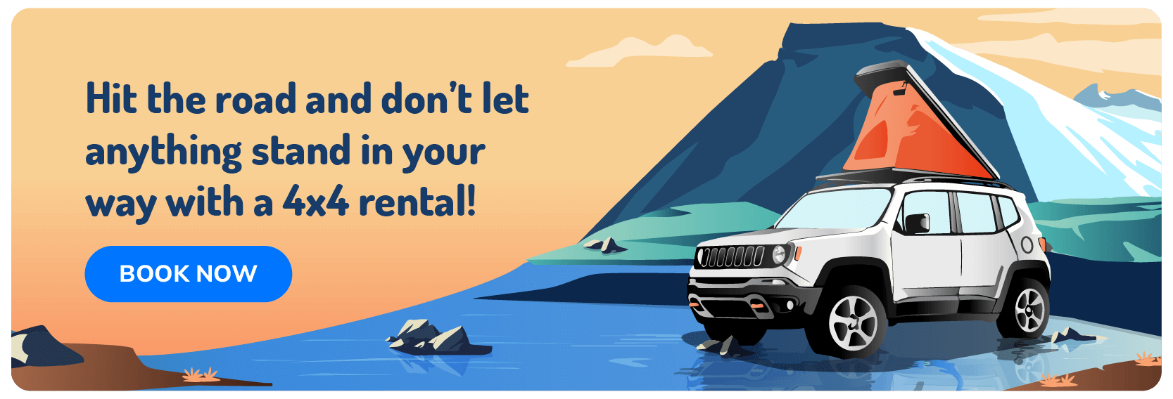
- Choose the right vehicle for your itinerary – Make sure your campervan is suitable for the roads you plan to drive, especially if you’re venturing into the Highlands or on gravel roads.
- Respect local laws, driving rules and the environment – Follow all driving and camping regulations to protect Iceland’s fragile landscapes and avoid fines.
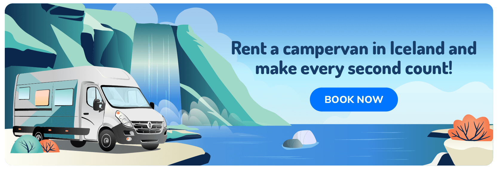
Explore Iceland’s Roads on Your Own Epic Adventure
Campervan travel in Iceland offers unparalleled freedom and adventure. By following this guide, you’ll be well-prepared for a safe, enjoyable and unforgettable road trip through Iceland’s stunning landscapes.
Find your ideal Iceland campervan rental here, perfect for the vacation of a lifetime. Ready? Let’s go!